Geology of Ohio
The western part of Ohio contains limestone, along with dolomite. This rock type is relatively non-resistant due to the humidity, and because of this and all the erosion, since the rock first formed about 200 million years, this part of Ohio is now a flat landscape.
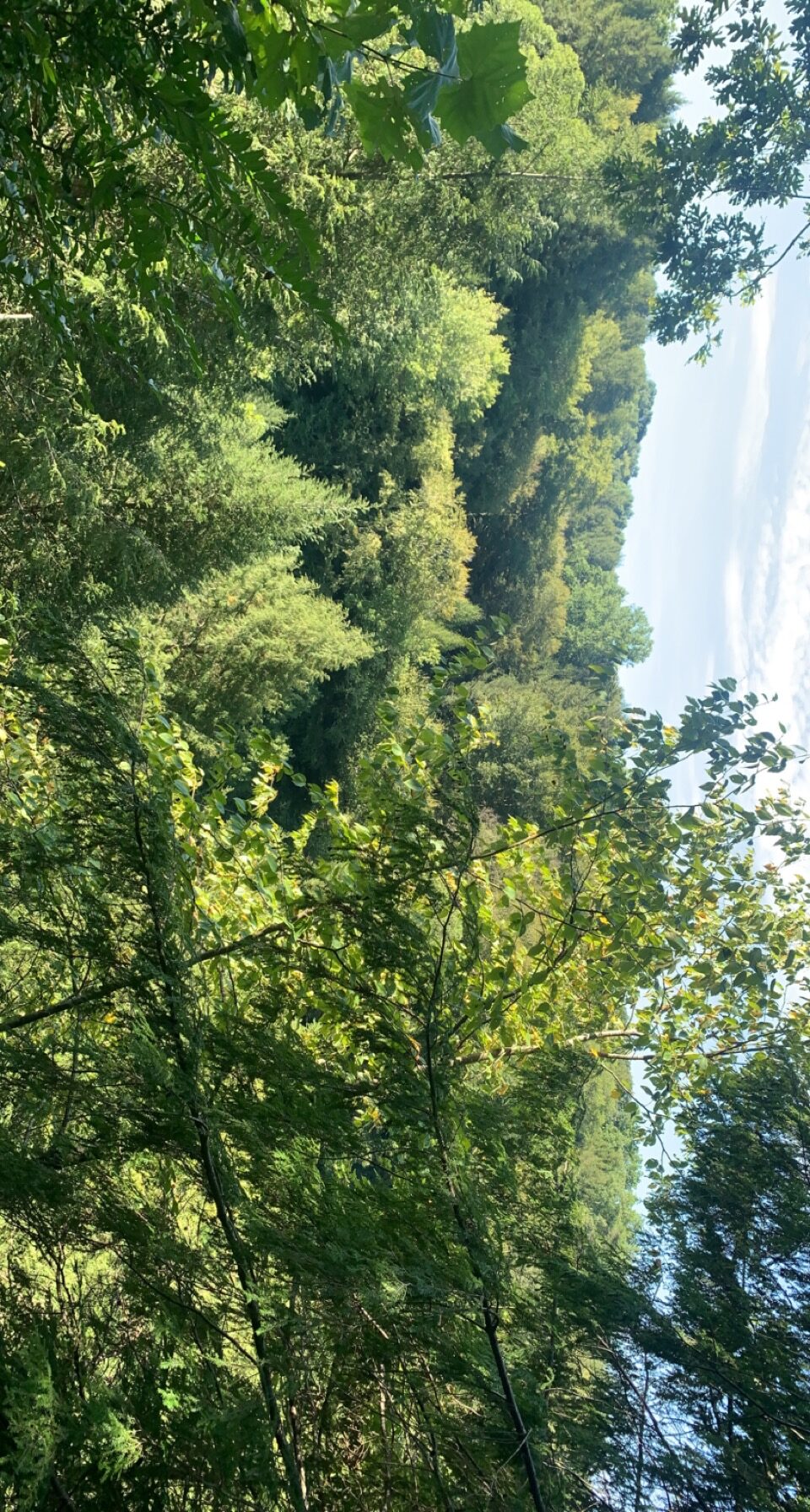
The other part of Ohio is the eastern part and is dominated by sandstone which is a pretty resistant rock and is also underlain by shale on the west side through Cleveland. This sandstone has been eroded over time by the natural cement which holds these grains together through the water that readily goes through the rock. The dissolving of this cement is a relatively slow process even though water goes through sandstone easily, which allows the rock to be resistant. The shale, on the other hand, is not very resistant and therefore is being worn down in areas that aren’t protected by sandstone. This erosion in east Ohio has led to deep valleys and has formed a landscape of steep-sided sandstone hills and sandstone-capped hills in Cleveland.
Sedimentary Rock Strata
The original sequence of sedimental rock strata is a thick series of limestone layers overlain by shales and the shales are overlain by sandstones. They were tilled gently into the form of a low arch before erosion began, which was in a way a product of pressures that about 200 million years ago created the Appalachian Mountains on the east. The erosion after cut deepest where the arch is at its highest exposes the oldest rocks along the crest and extends north-south through western Ohio. The older rocks, limestone, are found throughout western Ohio and the nonresistance has led to erosion of the western part of the state down to an almost flat plain. The eastern part which is away from the crest of the arch lies in the youngest rock layers, the resistant sandstones were not removed, erosion cut deep into the rock strata and did not erode it away completely, and this led to the sandstone hills which are known in this area.
Most of the erosion of limestone in western Ohio and shale and sandstone in eastern Ohio was put forth by a famous preglacial stream, the Teays River. This river along with others like it has been in Ohio for about 200 million years. It is known that the streams continued to erode the land throughout this long time, and were only reduced by the advance of the glaciers of the Ice Age less than a million years ago.
Glacial Boundary
The Pleistocene glaciers invaded Ohio a few hundred thousand years ago or less, the feature of the landscape that slowed the glaciers was the steep-sided sandstone hills of eastern Ohio, and this caused there to be a glacial boundary cutting across Ohio. This glacial boundary was no farther south than the latitude of Canton, Ohio, but the broad limestone plains of western Ohio were extended as far south as northern Kentucky because there was nothing stopping the ice on this side.
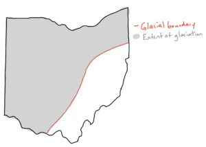
Glacial boundary map of Ohio
Glacial Till
Till has accumulated directly by melting ice, and sand and gravel materials deposited by the glacial meltwater. Till occurs as a broad and continuous blanket over almost all of glaciated Ohio, the sand and gravel deposits are local features occurring only within one river valley or one hill. The composition of till reflects mainly the nature of the geologic materials such as bedrock or earlier glacial deposits over which the glacier moved that left the deposit.
In eastern Ohio, most of the till contains small amounts of lime and clay, and near the margins of the area of sandstone hills, where the ice moved from limestone bedrock into sandstone, the till is higher in both lime and clay than in other spots in eastern Ohio. In western Ohio, the glacial till is rich in lime and clay, which are products of the glacial abrasion of the limestone bedrock.
Basic Substrate for Plants in Western and Eastern Ohio
In western Ohio plains, the main substrate is limy, clayey till which provides a relatively impermeable soil, high in lime but poorly drained and inadequately aerated. For this soil, water does not soak in fast and rather tends to remain on the surface, which creates low oxygen availability in wet times and bad drouths in dry spells. The plant nutrient supply is comparatively abundant. When the glacial till is thin or not present, a condition found locally, the soil on the limestone is usually very shallow, very high in lime, rich when it is not too thin, and very dry due to excessive drainage through natural solution openings, sometimes known as cavelets, in the soluble limestone.
In eastern Ohio, the very permeable sandstone bedrock, where it is exposed, produced a very acid, low-nutrient substrate that is dry on the tops of the hills especially. On a local level, the sandstone crops out at lower elevations. In this, it is also acid but provides a supply of moisture that is continually available and cool because it comes from springs, the water that has percolated through the permeable sandstone and emerged deep in the valleys without being warmed in the sun. The shale that is below the sandstone in areas also produces a usually acid-low-nutrient substrate, but differently from the sandstone, it is impermeable. As a result, surface water usually runs off rather than soaks in, which makes it a drouthy substrate during long dry spells. Additionally, shale may be present as layers within the sandstone, and in these areas, the cool acid water moving through the sandstone cannot extend deeper and emerges on the hillsides as springs. Where the sandstone is mantled by till, the amounts of clay and lime in the till lead to less acid, moister, and more nutrient-rich soils The will that is near the margins of the sandstone area has greater amounts of clay and lime, which results in substrates similar to those in the till of western Ohio.
Trees/shrubs Distributions Limited to Limestone or Limey Substrates
Redbud (Cercis canadensis) is a tree that is limited to limestone or limey substrates. I found this particular tree at Battelle Darby Creek Metro Park (BDCMP). It is in the pea family, Fabaceae, and is sometimes called the Judas tree because it was said that the buds turned red on the tree when it became embarrassed when Judas hung himself on the tree.

Redbud (Cercis canadensis) distribution limited to limestone or limey substrates
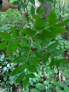
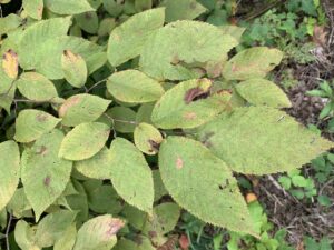
Hackberry (Celtis occidentalis) is a tree that is limited to limestone or limey substrates. I found this tree at BDCMP as well. It is in the Ulmaceae family, and the fruits on the tree are edible to humans and animals and rely on animals to eat the fruits and disperse the seeds.

Hackberry (Celtis occidentalis) distribution limited to limestone or limey substrates
Blue ash (Fraxinus quadrangulata) is a tree that is limited to limestone or limey substrates, and was also found at BDCMP. Blue ash belongs to the Oleaceae family, and was used by early colonists to made blue dye which was created by the sap when it is exposed to air.
blue ash (Fraxinus quadrangulata) distribution limited to limestone or limey substrates
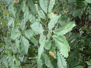
Chinquapin oak (Quercus muehlenbergii) is a tree that is limited to limestone or limey substrates, and was also found at BDCMP. Chinquapin oak is in the Fagaceae family, the liquid merchandise of chinquapin oak was commonly rolled onto the boat in barrels because the pores are plugged by nature and helps against leakage.
chinquapin oak (Quercus muehlenbergii) distribution limited to limestone or limey substrates
Hop hornbeam (Ostrya virginiana) is a tree that is limited to limestone or limey substrates, and was also found at BDCMP. Hop hornbeam is in the Betulaceae family. Hop hornbeam wood is so strong and durable, it is often used to make fence posts and tool handles, the inner wood was also used by Native Americans to treat toothaches, sore muscles, and coughing.
Hop hornbeam (Ostrya virginiana) distribution limited to limestone or limey substrates
Others not found include: red-cedar (Juniperus virginiana), fragrant sumac (Rhus aromatica), and hawthorn (Crateagus mollis).
Trees/shrubs Distributions Limited to High-lime, Clay-rich Substrates Developed in the Thick Glacial Till of Western Ohio
sugar maple (Acer saccharum)
beech (Fagus grandifolia)
red oak (Quercus borealis)
shagbark hickory (Carya ovata)
white oak (Quercus alba)
white ash (Fraxinus americana)
swamp white oak (Quercus bicolor)
pin oak (Quercus palustris)
Trees/shrubs Distributions Limited to Sandstone Hill of Eastern Ohio
chestnut oak (Quercus montana)
sourwood (Oxydendrum arboreum)
scrub pine (Pinus virginiana)
hemlock (Tsuga canadensis)
mountain maple (Acer spicatum)
mountain laurel (Kalmia latifolia)
huckleberry-blueberry (Vaccinium ssp.)
trailing arbutus (Epigea repens)
greenbrier (Smilax glauca)
Major Determinant of the Distribution
Sweet buckeye (Aesculus octandra) does not occur inside the glacial boundary, the determinant for this distribution is not known, but could have to do with problems of repopulation, by these plants, of the clayey, high-lime glacial tills in the short time since the ice left Ohio. The reason why sweet buckeye does not go as far north as the glacial boundary in eastern Ohio is not clear as well, it could be because the climate is the controlling factor, and there is no geologic discontinuity known along the edge of its distribution.
Hemlock (Tsuga canadensis) occurs in unglaciated eastern Ohio as well, but in contrast to sweet buckeye, its distribution extends far to the north, well north of the glacial boundary in that area. The determinant of the more extensive distribution here is because of its restriction to continuously cool, moist environments such as are found in bottoms of deep valleys cut into the sandstone and watered by cool spring water in the south, or that occur in valleys in the north that contain some till but remain cool and moist because they are deep and open to the north. Even though till thickness are usually greater north of the glacial boundary, having less acidic soils, the cool moist north-facing valleys are good enough for hemlock to occur. The sweet buckeye is a plant restricted to unglaciated areas, while the hemlock is a plant that occupies moist valley-bottom sites in sandstone.
Rhododendron (Rhododendron maximum), is a plant species that is seen south of the glacial boundary, this distribution might suggest that they belong to the mixed mesophytic association in Ohio, even though they do not occur everywhere in the unglaciated area. The only time a major determinant of this distribution is apparent, is when the distribution is compared with the location of the valleys in the ancient Teays system. According to Dr. E. N. Transeau and Dr. John N Wolfe, this species represents one that lived and still lives in the Appalachian highlands and migrated down through the preglacial Teays River system from that area north into southern Ohio. The glacial advance blocked the Teays River drainage and destroyed most of its valleys in Ohio, but the plants which have distributions in Ohio that were determined by this migration still remain, and live south of the glacial boundary and also live near the locations of some of the main valleys of the ancient river.
Cedar Bog Fen and Swamp Forest
Cedar Bog fen and swamp forest is the largest and best calcareous fen in Ohio. A characteristic plant here is white cedar. There are a lot of boreal, prairie, and coastal plain species that occur here. The plants present here are maintained by a continuous flow at the surface of cool groundwater which contains high lime. This water emerges as springs along the base of the east side of the Bog. This creates a cool moist microclimate. Cedar Bog fen is located on a thick filling of glacial outwash gravel in the Mad River valley.
Scavenger Hunt: Two Examples of Flowers with Bilateral Symmetry
I found three to make up for not being able to answer some questions because of not being able to go to these locations.
The first is the Bird’s foot trefoil (Lotus corniculatus), which is a species of Lotus. It is in the pea family, Fabaceae, and is a perennial that is native to Eurasia but was introduced to North America around 1900 and is widely distributed.
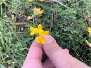
Bird’s foot trefoil (Lotus corniculatus)- Bilateral symmetry
The second is yellow jewelweed (Impatiens pallida), also known as a Yellow touch-me-not, which is a species of Jewelweed. It is in the family Balsaminaceae, and is found more predominantly in the New England area, but can be found in other areas, especially those containing terrestrials or wetlands.
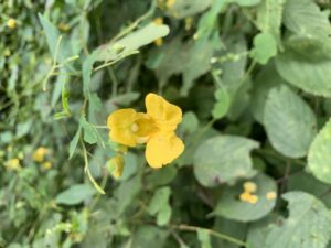
Yellow jewelweed (Impatiens pallida)- Bilateral symmetry
The third is orange jewelweed (Impatiens capensis), also known as a spotted touch-me-not, which is a species of Jewelweed. It is in the family Balsaminaceae, and is found in moist, semi-shady areas in northern and eastern North America. The orange jewelweed also has a history of use in Native American medicines, such as itching relief.
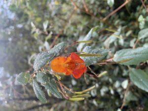
Orange jewelweed (Impatiens capensis)- Bilateral symmetry
Conservative Plants with High CC Values
Swamp Thistle (Cirsium douglasii) – CC value= 8. Since I was not able to make it out to Cedar Bog, I got this image instead online.
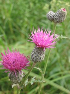
Swamp Thistle (Cirsium douglasii) with a CC value of 8
Northern White Cedar (Thuja occidentalis) (aka arbor vitae)- CC value= 9. I was not able to go to Cedar Bog and get a picture of this species, but we had an example of it in field experience so I used that.
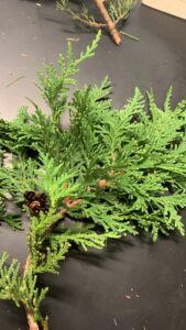
Northern White Cedar (Thuja occidentalis) (aka arbor vitae) with a CC value of 9
Ohio Goldenrod (Solidago ohioensis)- CC value= 9. I was not able to make it out to Cedar Bog to get an example of this species, and found a good example online.
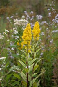
Ohio Goldenrod (Solidago ohioensis) with a CC value of 9
Sundew drops (Drosera rotundifolia)- CC value= 7. I was not able to get a real example from Cedar Bog, but got an example online.
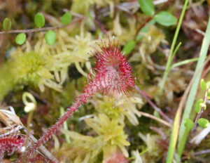
Sundew drops (Drosera rotundifolia) with a CC value of 7